Nathula Pass: Height, Weather and Is It Worth Adding?
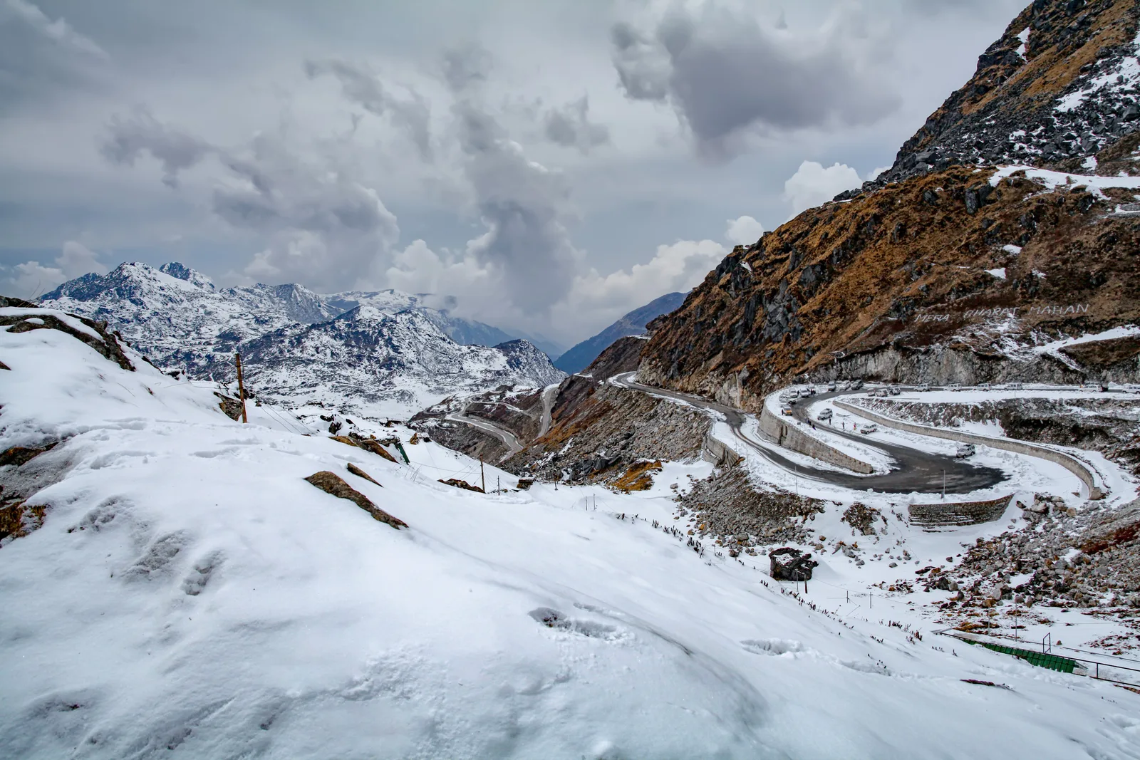
Nathula Pass is 14,140 ft (4,310 m) high and 58 km from Gangtok. The weather season by season, how the altitude feels on a day trip, the reopened border trade, and whether to add it.
The short answer
Nathula Pass is 14,140 ft (4,310 m) high, 58 km from Gangtok: snowy December to April, moderate in summer. Worth adding if all are Indian nationals and fit.
- It is 17 km and about an hour beyond Tsomgo Lake, and some 1,840 ft (560 m) higher. From Gangtok you climb about 8,200 ft (2,500 m) in two hours.
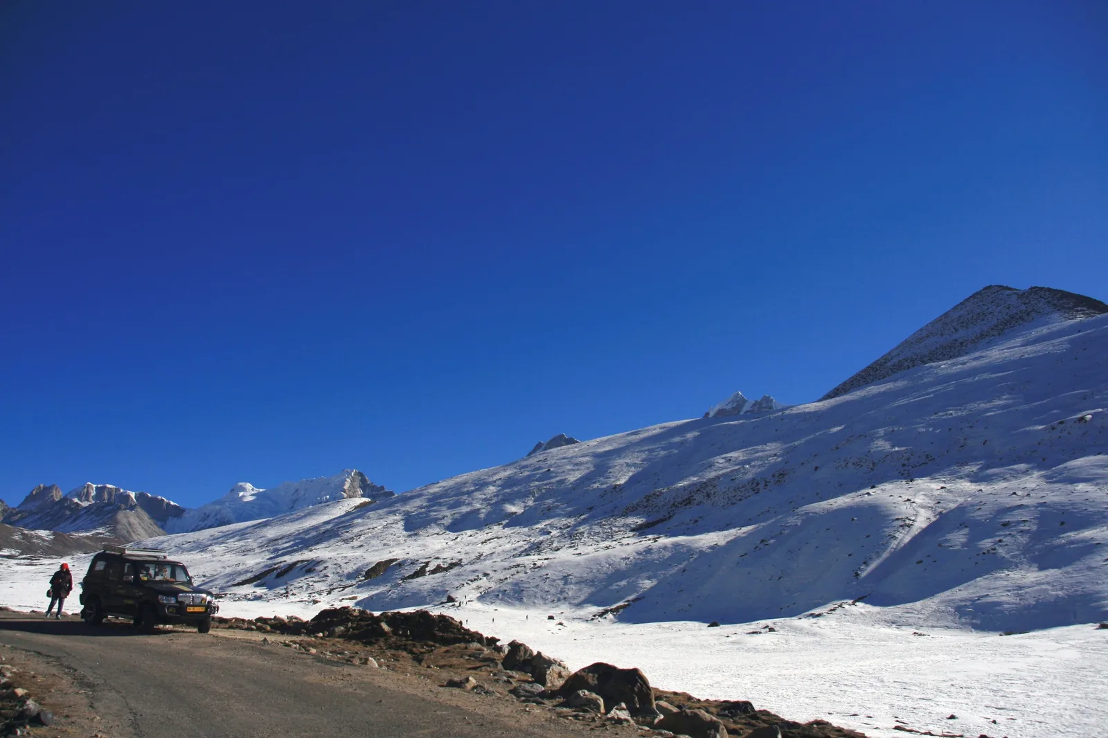
- Snow is surest from January to March; October and November bring the clearest skies; June to September is rain and cloud.
- A day trip is the gentlest way to go high: the CDC says trips that come back down the same evening are much less stressful on the body.
- Closed on Mondays, Indian nationals only. Open days, ID and permits are in the Nathula permit guide.
Trips you can book for this
If only Nathula is shut on the day, the Nathula days still go to Tsomgo Lake and Baba Mandir.
Quick facts
Checked Oct 2026
- Height
- 14,140 ft (4,310 m)
- From Gangtok
- 58 km, about 2 hours
- Beyond Tsomgo Lake
- 17 km, about 1 hour
- Snow
- About December to April; surest January to March
- Clearest skies
- October and November
- Open
- Tuesday to Sunday; Indian nationals only
How high is Nathula Pass?
Nathula Pass is 14,140 ft (4,310 m) high, says the Ministry of Tourism: about 8,200 ft (2,500 m) above Gangtok and 1,840 ft (560 m) above Tsomgo Lake.
You will see other figures. The Gangtok district administration rounds it to 4,300 m, and some travel pages say 14,450 ft. This guide uses the Ministry of Tourism’s 4,310 m (14,140 ft).
What matters on the day is the climb. The India Meteorological Department’s Gangtok station is at about 5,790 ft (1,765 m) and Tsomgo Lake at 12,313 ft (3,753 m), and the road reaches the pass in about two hours from town. That is a big climb for one morning, which is why the weather and your body get their own sections below.
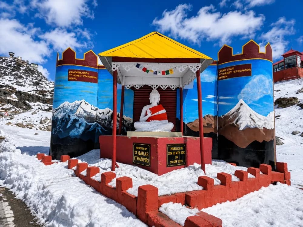
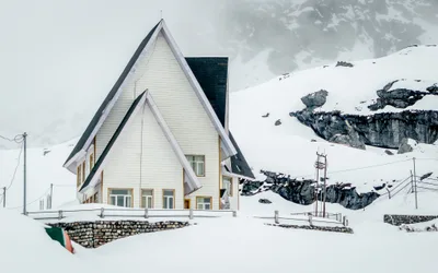
At the top, stairs lead up to a viewpoint over the border, with a war memorial, an army exhibition centre and shops close by. The Nathula permit guide describes the top in detail.
How far is Nathula Pass from Gangtok?
Nathula is 58 km from Gangtok by road, about two hours’ drive: 41 km to Tsomgo Lake, then 17 km and about an hour more.
The road climbs past the 3rd Mile check post, the tea stalls at 17th Mile and Tsomgo Lake to Baba Mandir, and then to the pass. The Gangtok district page gives 56 km from town, or 58 km from the SNT bus station.
The shared day goes up to the pass first, then stops at Baba Mandir and Tsomgo Lake on the way down. Its plan gives about half an hour at the top.
Distances from Gangtok has the other roads, and every day you can book from Gangtok is on the Gangtok page.
What is the weather like at Nathula, season by season?
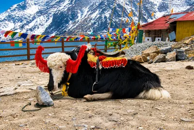
Very cold in the winter months and moderate in summer, operators say; snowy from about December to April and surest from January to March; wet and cloudy from June to September; clearest in October and November.
There is no official temperature record for the pass itself that we could find, so this guide describes the seasons rather than quoting numbers. Expect it to be far colder than Gangtok on the same day.
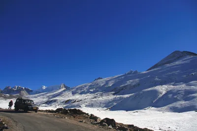
- January to March: the deepest cold and the surest snow. Heavy falls can stop permits for a day or two.
- April and May: the snow thins out. Sikkim Tourism notes that snow lingers until the end of March in most high places.
- June to September: the monsoon. Sikkim Tourism says rain is heavy from May to early October and July is the wettest month, and cloud can hide the view.
- October and November: the clearest skies. Sikkim Tourism’s season for crisp, clear views runs from October to mid-December.
- December: the start of the snow season, and one of the driest months in Gangtok.
Nathula in December
Early December still falls in Sikkim Tourism’s clear-view season, and the month is very cold, with the first snow of the season on some days and not on others. Snow can close the road at short notice, so leave a spare day in your plans.
Nathula in May
May is milder, with snow at the pass some years and not others, as Sikkim’s weather is hard to predict, operators say; cloud builds as the rains come.
If only the pass is shut on the day, the Nathula days still go to Tsomgo Lake and Baba Mandir. Does it snow in Gangtok? explains snow closures and refunds.
Is Nathula worth adding to a Tsomgo Lake day?
Yes, if everyone in your car is an Indian national in good health and your date isn’t a Monday. It adds the border viewpoint, the highest point of the day, and one to two hours.
What you gain:
- The pass itself: the viewpoint over the border, the war memorial and the army exhibition centre.
- Height: Nathula is some 560 m above the lake, the top of the road for visitors.
- All three sights in one day: the pass, Baba Mandir and Tsomgo Lake.
When to leave it out:
- If anyone has a heart condition, high blood pressure, asthma or a breathing problem: see who should skip Nathula.
- On a Monday, when the pass is closed.
- In a group with foreign nationals or OCI card holders: the car stops at the lake.
The private day lets you decide: Tsomgo Lake and Baba Mandir as the base, with Nathula added at checkout. Operators say the pickup time stays the same and you are back about one to two hours later. If the authorities don’t issue the Nathula permit, the add-on is refunded.
A trip you can book
 Gangtok, SikkimTsomgo Lake & Baba Mandir Day trip with Optional Nathula PassFull dayHotel pickupFull refund up to 24 hours beforefrom $43per vehicleSee the trip →
Will you feel the altitude at Nathula?
Some people do, but a day trip is the gentlest way to go this high: the CDC says trips that return to a lower altitude the same evening are much less stressful on the body.
The US Centers for Disease Control and Prevention (CDC) puts the risk of altitude illness mainly on travellers who sleep at 8,000 ft (2,450 m) or higher, and says oxygen levels in the blood drop most during sleep. Every day to Nathula listed here takes you back to Gangtok, at about 5,790 ft (1,765 m), for the night.
Acute mountain sickness usually starts 2 to 12 hours after arriving high, the CDC says: a headache, with tiredness, dizziness, nausea or loss of appetite. Going down 300 m or more usually brings quick relief, and on this road the way down is never far.
Children feel altitude as much as adults, the CDC says, and people over 50 slightly less. It advises no alcohol in the first 48 hours at altitude, and the shared day’s listing asks every traveller to be sober.
Some conditions need a doctor’s view before you go, including heart disease, chronic lung disease and poorly controlled asthma. The listings say these days aren’t suitable for pregnant women or people with heart conditions.
Portable oxygen cans, at shops on the road up: about ₹500 each (operators) · checked Oct 2026
What is Sherathang, and is the border trade open again?
Sherathang is the trade mart for India–China border trade through Nathula, which restarted on 1 August 2026 after a six-year pause.
The reopening ceremony was held at the Sherathang Trade Mart. Under the agreed rules, The Tribune reported, trade runs from May to November each year, Monday to Thursday, in a list of 36 notified goods.
The trade days are not the visitors’ days: for tourists, Nathula is closed on Mondays only, operators confirmed in October 2026. Visitors usually aren’t allowed into the Sherathang mart, though on some days they are, operators say, and no day listed here plans a stop there.
Pilgrims use the pass too. The Kailash Mansarovar Yatra resumed through Nathula a few weeks before the trade did, The Tribune noted.
Nathula or Zero Point: which is better for snow?
Both are high and snowy in winter. Nathula is one day from Gangtok, for Indian nationals only; Zero Point, above Yumthang, needs a two-night Lachung trip and is open to foreign nationals too.
Zero Point gets its snow earlier, operators say: from about November, and in some years October. At Nathula, snow is surest from January to March.
Zero Point is reached from Lachung, which is 116 km from Gangtok, so it comes as part of a two-night Lachung trip. On the Lachung trips listed on the Lachung page, it is an extra paid to the driver. Foreign nationals can go there as two or more with a registered guide, which they can’t do at Nathula.
One difference matters in bad weather. If only Nathula is shut, the Nathula days still go to Tsomgo Lake and Baba Mandir. If snow shuts Yumthang or Zero Point, operators say there is no other sightseeing up there to go to instead.
For a high day without Nathula, the Tsomgo Lake guide covers the lake month by month, and the Zuluk guide the old Silk Route.
What should you take up to Nathula?
A warm jacket, gloves and a hat in every month, sunglasses, cash, water, and the ID you gave for the permit.
17th Mile, on the way up, is where shops hire out snow boots, gloves and jackets. The stairs at the top are the hardest part of the day, so wear shoes with a good grip and take them slowly.
Snow boots, gloves or a jacket at 17th Mile: about ₹300–500 per item, depending on the shop, the material and the size (operators) · checked Oct 2026
Bring
- A warm jacket, gloves and a hat, in any month
- Shoes with a good grip for the stairs
- Sunglasses and sunscreen
- Cash for gear hire, tea and an oxygen can
- Water and a light snack
- Any medicines you take
Before you go
- A date from Tuesday to Sunday
- A word with your doctor if anyone has a heart, lung or blood-pressure condition
- Every traveller’s details, added to your booking by the cut-off
- A spare day in your plans in the snow months
- No alcohol the night before
Questions travellers ask
Can you see China from Nathula?
How long do you spend at the top of Nathula?
Is Nathula suitable for children?
Should I take medicine for altitude before Nathula?
Is Nathula open in winter?
Sources & checks
- Nathula: altitude 4,310 m; closed on Mondays — Incredible India, Ministry of Tourism, Government of India · checked Oct 2026
- Nathula: 4,300 m; about 56 km from Gangtok, 58 km from the SNT bus station; war memorial, army exhibition centre and shops — Gangtok district administration, Government of Sikkim · checked Oct 2026
- Altitude illness: risk from a sleeping altitude of 2,450 m, day trips much less stressful, symptoms and onset, descent, children, alcohol, and conditions that need a doctor’s view — CDC Yellow Book, US Centers for Disease Control and Prevention (High-Altitude Travel and Altitude Illness) · checked Oct 2026
- Nathula among the snow places; snow lingers until the end of March; heavy rain from May to early October; July the wettest; October to mid-December the clear-view season — Sikkim Tourism, Government of Sikkim (weather page) · checked Oct 2026
- Gangtok station height: 1,765 m — India Meteorological Department (climatological table, Gangtok) · checked Oct 2026
- Border trade through Nathula resumes after six years, Monday to Thursday (1 August 2026) — All India Radio News · checked Oct 2026
- Trade season May to November, Monday to Thursday, 36 notified items; the Kailash Mansarovar Yatra through Nathula (1 August 2026) — The Tribune · checked Oct 2026
- The reopening ceremony at the Sherathang Trade Mart (1 August 2026) — Northeast Now · checked Oct 2026
- Road distances from Gangtok to Tsomgo Lake, Nathula and Lachung — Day Trio, Distances from Gangtok (OpenStreetMap routing, October 2026) · checked Oct 2026
- The order of stops and time at the top, the Nathula add-on and its refund, sobriety, and who each day is not suited to — The days' own listings on Day Trio · checked Oct 2026
- Closed on Mondays only; snow months at Nathula and Zero Point; Zero Point for foreign nationals and as an extra on the Lachung trips; closures and what the days do instead; the add-on’s timing; oxygen cans and gear hire; children — First-hand: the author and the local operators who run these days · checked Oct 2026